San Mateo County Tsunami Awareness Week and new Tsunami Dashboard
Published on March 24, 2025
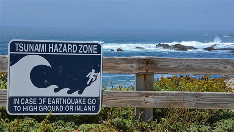
This week, San Mateo County is recognizing Tsunami Awareness Week with the launch of its new Tsunami Hazard Area Dashboard.
Tsunamis are caused by seismic events and can cause strong currents and flooding. In coastal regions, it is important to know how to detect and respond to signs of a tsunami. The Tsunami Hazard Map was created by the San Mateo County Department of Emergency Management to help identify areas that could potentially be impacted by a tsunami, allowing residents and visitors to prepare for tsunamis at their home, work or planned vacation destination.
With the help of the Dashboard, you can plan a route to reach the nearest safe location on high ground (areas inland, uphill and away from areas prone to flooding.) On the map, these are areas outside of the yellow Tsunami Hazard Zones.
The County of San Mateo provides additional information and resources including how to respond to messaging –– informational, watch, advisory and warning –– on its dedicated tsunami site. Menlo Park community members can receive alerts for local and County emergencies by registering for SMCAlerts. Community members can also receive updates by subscribing to our City newsletter, the Weekly Digest.
Check out the Tsunami Hazard Area Dashboard to see if your home, work or locations you visit are in a Tsunami Hazard Zone.